


Asset & Infrastructure Intelligence
Aerial. Ground 360. Confined Space. Submerged & Underwater Asset Inspection & Condition Intelligence
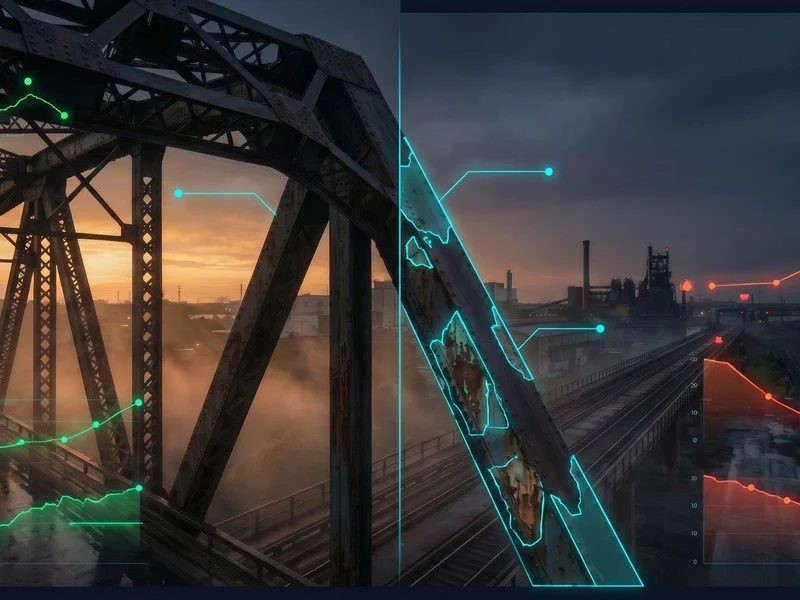
All Assets, All Environments, 360 degrees
Reduce inspection costs by 40-70%. Minimise shutdowns. Get engineering-grade condition data across every environment.
CASA ReOC
ISO 9001
ISO 14001
ISO 45001
$20m Public Liability Insurance
CASA Certified ReOC & OONP, EVLOS I & II, Enclosed BVLOS, Sheltered Operations, Night Operations
Bridge Inspection Level 1
CASA ReOC ISO 9001 ISO 14001 ISO 45001 $20m Public Liability Insurance CASA Certified ReOC & OONP, EVLOS I & II, Enclosed BVLOS, Sheltered Operations, Night Operations Bridge Inspection Level 1

Our Services
-
Asset and Infrastructure Inspections and Condition Mapping
Visual, LiDAR and thermal drones, robotics, and 360 cameras for inspection and condition reporting for buildings, rail, roads, bridges, infrastructure, roofs, other assets and facades.
-
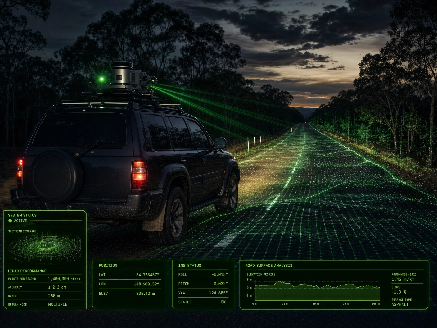
Mobile Mapping & Road Intelligence
Capture your entire road infrastructure network. No closures. No traffic management. 2cm survey-grade accuracy with 360-degree measurable digital twins.
LiDAR point clouds, condition heatmaps, cross-section profiles, and automated defect detection. We combine vehicle-mounted 360° imagery with survey-grade LiDAR to deliver measurable digital twins of roads, corridors, and street-level assets without disrupting traffic.
100% network coverage vs 5-10% from traditional sampling
-
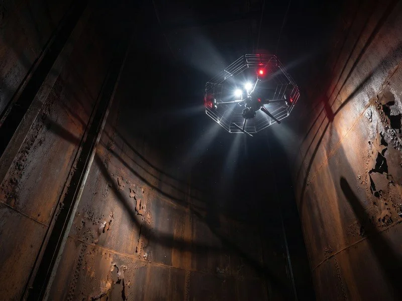
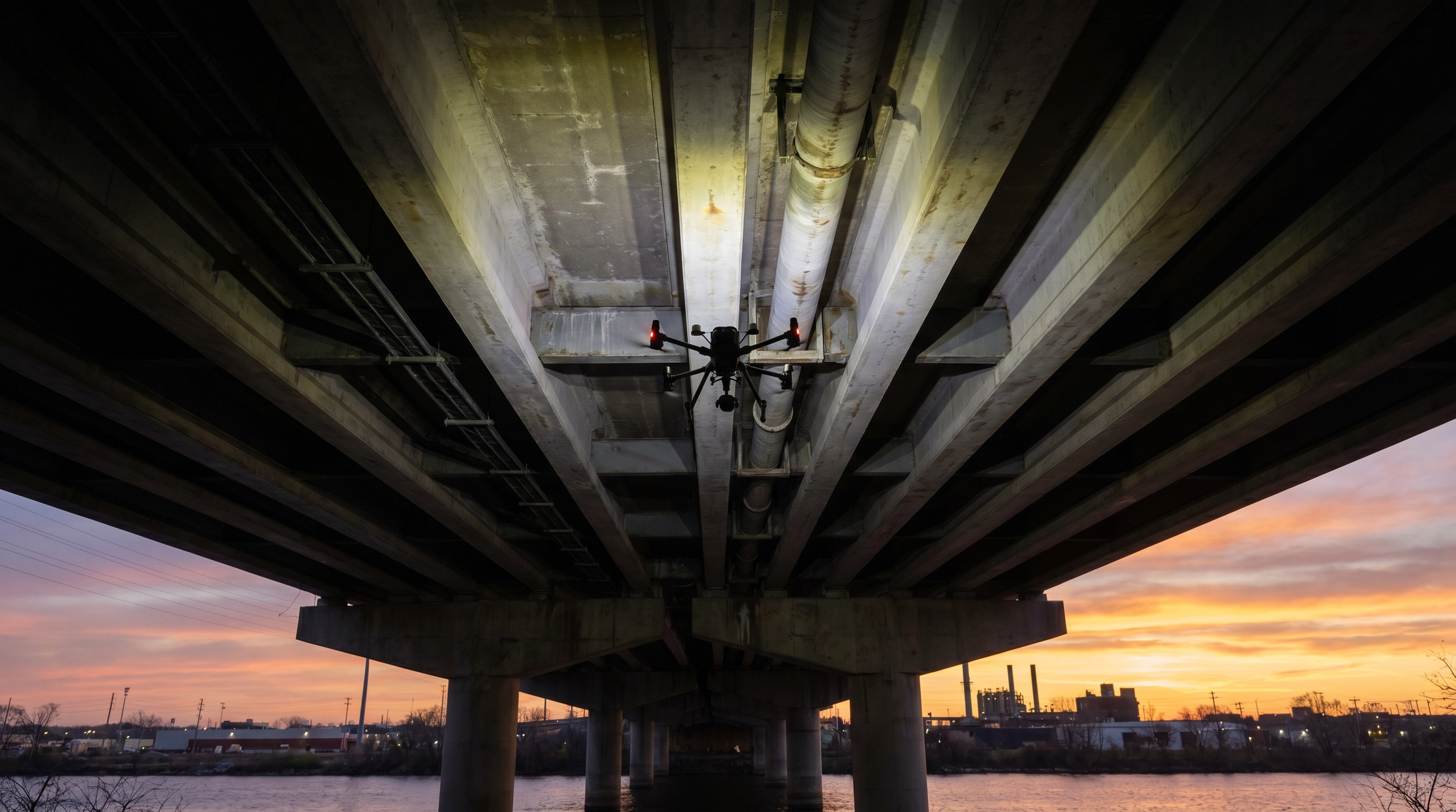
Confined Space and Interior Inspection
Internal, high-risk and confined space asset inspections with specialised drones, robotics, LiDAR, Visual, Thermal, ultrasound-mounted NDT and underwater ROV’s for safer assessment without human entry or the shutdown costs
-
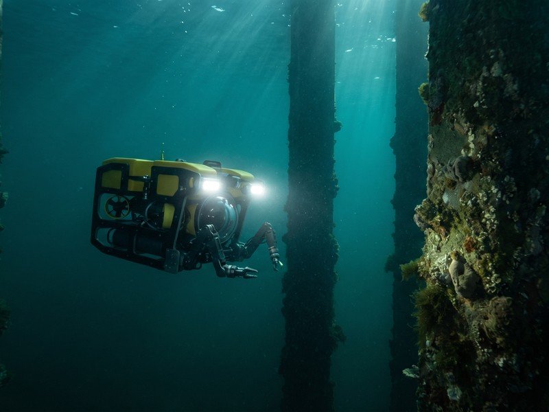
Underwater Inspections & Digital Twins
Submerged inspections, defect and detection, mapping and digital twin intelligence for ports, hulls, marinas, cables and other submerged assets and infrastructure
-

Thermal and Condition Assessment
Radiometric, thermal imaging and analysis for moisture ingress, energy loss, risks identification, building envelope failures, electrical, mechanical, and structural anomalies.
-

Digital Twins and 3D to 8D Modelling
Millimetre-level accurate digital twins and interactive 3D to 8D models, with optional IoT integration for remote asset assessment, monitoring, management and planning.
-
Ongoing Asset Insights, Trends and Remote Monitoring
Scheduled repeatable inspection programs with change detection trends, time-lapse condition monitoring, and defect tracking visibility
-
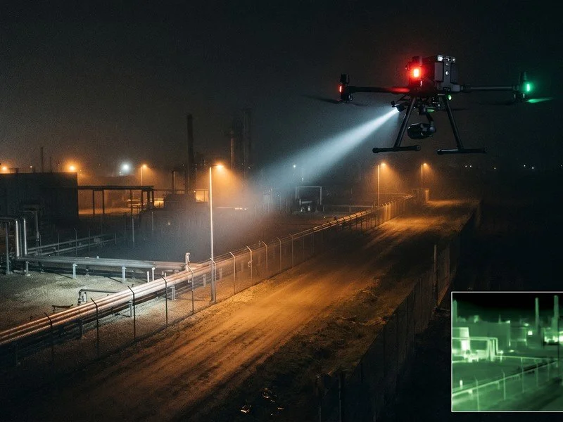
Security, Safety and Search and Rescue
Autonomous drone and robotic security, surveillance, situational awareness, medical, search and rescue response and disaster support.
-
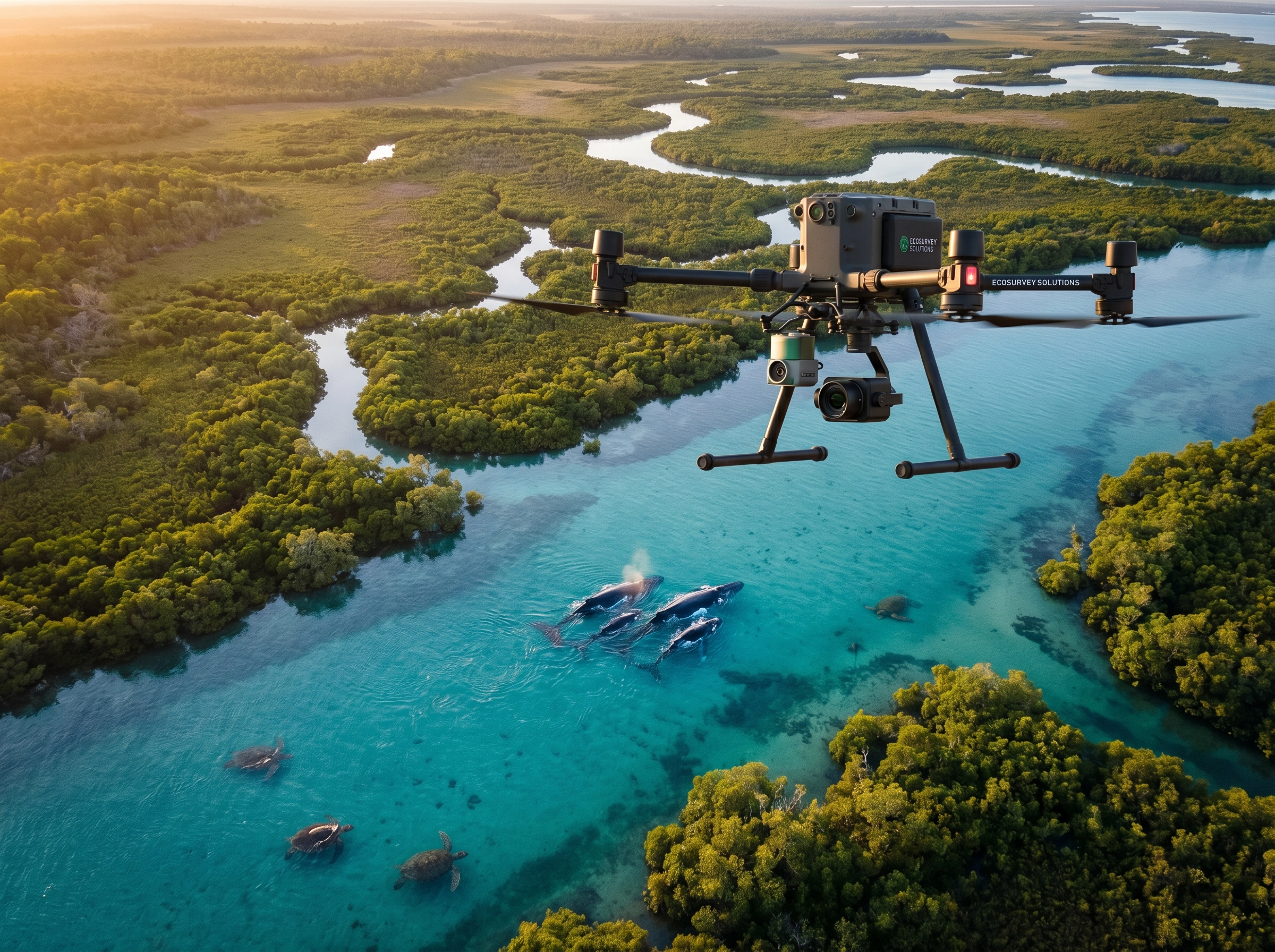
Environmental and Conservation Intelligence
Wildlife species detection and tracking; habitat and erosion mapping; bathymetry; forestry; volumetrics; vegetation health; plant, pest, diseases, and weed detection for environmental monitoring, management and compliance.
Industries
DeepSky IQ delivers independent inspection, mapping, detection, digital twins, remote monitoring, and analysis to support real-world visibility, audit readiness, lifecycle planning, and risk governance at the project and portfolio scale.-
Independent inspection and spatial intelligence services supporting power & energy services, bridges, roads, rail and tunnel infrastructure, utilities such as hydro and dams, transport infrastructure.
DeepSkyIQ delivers high-resolution, geo-accurate visual, thermal, lidar, photogrammetry and spatial data to produce time-stamped digital records and defensible condition assessments across complex infrastructure assets and portfolios.
Outputs support structured annual inspection programs, condition visibility, digital twins 3D to 8D, risk assessment, lifecycle planning, and compliance reporting without scaffolding, shutdowns, confined space or hazardous access.
-
Independent inspection, reality capture, and digital reconstruction services supporting planning, design coordination, construction monitoring, and asset handover.
High-resolution visual, thermal, and spatial intelligence enables progress tracking, defect documentation, condition baselining, and as-built 3D to 8D digital twins.
Outputs integrate with BIM and CAD workflows, supporting engineering, construction trades and project teams without replacing regulated surveying or engineering services.
-
Independent inspection, drone, ROVs, handheld scanners, confined spaces to submerged assets.
Thermal, liDAR, mapping, defect racking and digital twin reconstruction services, supporting power generation, transmission, substations, renewable assets, mining infrastructure, and processing facilities.High-resolution visual and thermal inspection intelligence supports defect identification, trend analysis, maintenance planning, and regulatory compliance across remote and high-risk environments.
3D to 8D Digital twins and time-series inspection records enable structured asset monitoring programs without intrusive or unsafe access across Energy, Utilities and Resource Sector assets and Infrastructure.
-
Multi-environment drone and underwater inspection services supporting ports, terminals, wharves, jetties, pylons, seawalls, breakwaters, and coastal infrastructure.
DeepSkyIQ delivers aerial and underwater asset condition assessments documenting corrosion, marine growth, scour, structural cracking, movement, and surface degradation.
Time-stamped digital reconstructions support marine asset management programs, risk assessment, insurance review, and defensible compliance reporting without diver exposure or operational shutdown.
-
Drone and robotic-enabled onsite and remote monitoring delivers measurable operational advantages, with our edge computing capabilities you can spend less time analysing and more time managing.
Improved Environmental Coverage
Survey large areas quickly and efficiently while maintaining detailed environmental visibility.
Faster Detection of Emerging Issues
Identify ecological threats earlier, enabling faster response and mitigation.
Reduced Field Survey Risk
Minimise the need for personnel to access difficult or hazardous terrain.
Evidence-Based Environmental Management
Generate accurate datasets that support regulatory compliance and environmental planning.
Cost-Effective Monitoring
Reduce the cost and time associated with traditional field surveys.
-
Independent data capture and inspection documentation, and digital reconstruction services supporting government agencies and public asset owners responsible for transport, utilities, civic facilities, recreational and critical infrastructure.
Time-stamped, spatially accurate digital records provide portfolio-wide visibility of asset condition, supporting maintenance prioritisation, capital planning, audit readiness, and governance oversight.
Structured inspection programs align with procurement, compliance, and lifecycle management frameworks.
-
Independent, audit-ready drone inspection and digital evidence services supporting insurance and legal matters.
DeepSkyIQ delivers interior, exterior, site, and scene capture using high-resolution visual, thermal, and 3D digital reconstruction across aerial, interiors, confined space, and underwater environments.
Georeferenced digital outputs support underwriting review, claims validation, dispute resolution, and litigation processes, helping reduce risk exposure and deliver defensible technical evidence.
-
Independent drone inspection and digital twin services supporting body corporate managers, facilities teams, stadium operators, hotel groups, and retail portfolio owners.
DeepSkyIQ delivers visual, thermal, defect detection and condition reporting across the building envelope, from façade inspections, roof condition assessments, structural observations, mechanical, electrical defect detection, waterproofing validation, and compliance documentation across distributed property portfolios.
Structured annual inspection programs reduce disruption, while generating audit-ready digital records for insurance, governance, and capital planning decisions.
Not seeing your environment listed? Request a confidential capability briefing to discuss your assets and requirements.Client Outcomes & Feedback
-
"Comprehensive, reliable, and professional in their approach."
— Insurance Lawyer, Engineering Grade Digital Twin - Queensland
-
"A professional team that delivered"
Delivered a detailed thermal and visual defect detection and condition report for the roof of a high-rise, plus façade defect mapping in a high-density urban area
— Body Corp, Condition Report & Maintenance Program - Gold Coast, Queensland - -
Delivered a 360 degree digital twin, suitable for detailed remote engineer inspection
Inspection grade digital twin, across multiple structures. No delays for ropes or scaffolding, so minimal operational impact, with faster information within hours, and safer.
Insurance Firm - Queensland
-
"Highly recommend, they are competitively priced and cater across industries"
Private Client - Thermal Search
Request a capability briefing
To scope independent inspection, mapping, digital reconstruction, security, or asset intelligence services aligned to your risk, governance, and decision-making requirements.
Delivering measurable reductions in rework, risk exposure, cost and delivery uncertainty across all environments.
Our Divisions
Technology-Driven Asset Services: Four Divisions. Four Specialist Capabilities. One Integrated Partner.
Inspection, Digital Twins, Spatial Data, Condition ReportingEnvironmental monitoring, conservation, land managementAutonomous security, SAR, disaster response, public safetyDrone & traditional ground softwashing, pressure washing, exterior maintenance