

Inspection and Condition Intelligence
Drone, Thermal & 360 Inspections, AR Overlay condition reporting, and Digital Twins
Independent, evidence-led: aerial, confined space, interior, and underwater data Acquisition to accelerate your projects and reduce costs
Traditional Inspection Models Increase Cost, Risk and Disruption
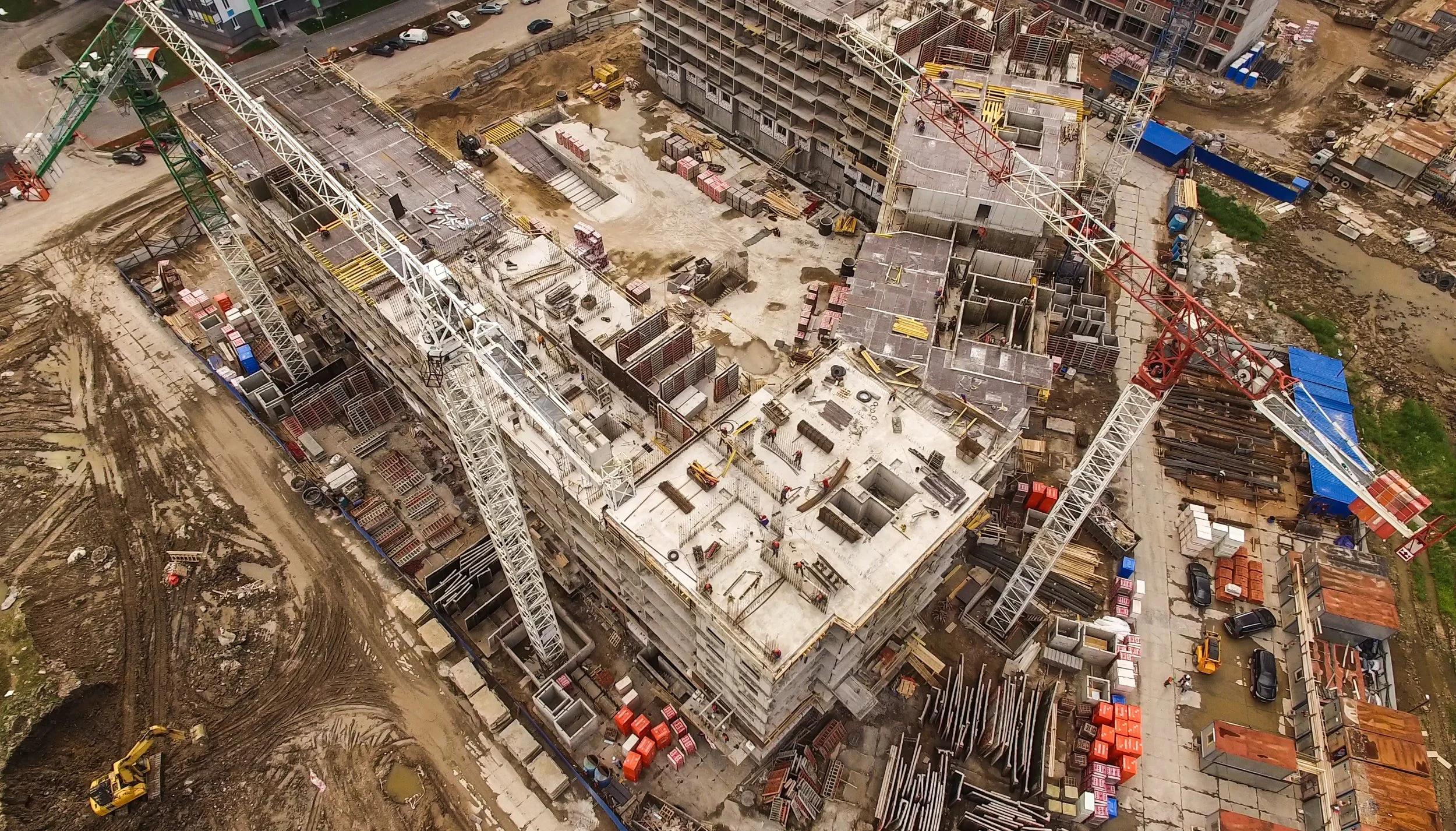
Industrial inspection services often rely on scaffolding, scissor lifts, rope access, confined-space entry, and diver deployment. These approaches increase safety exposure, delay inspections and completion, inflate access costs, and disrupt live operations for longer periods.
Across infrastructure and asset portfolios, inconsistent inspection reporting, issue awareness, and reduced time series comparability weaken defensibility and limit confidence in long-term maintenance planning.
High-risk access and WHS exposure
Incomplete and inconsistent reporting
No structured year-on-year comparability
Shutdown dependency and disruption
Inflated access costs and lost productivity
Delayed defect detection driving reactive maintenance cycles
Our Inspection Intelligence Framework
-
01. Capture Planning
Standardised inspection protocols aligned to asset class and risk profile, incorporating repeatable capture planning, RTK/PPK positioning and airspace compliance.
-
02. Multi-Sensor Acquisition
Drone inspection services, thermal inspection, LiDAR, mapping, hyperspectral, multispectral, ground robotics, 360 reality capture and underwater ROV deployment across complex environments.
-
03. Spatial Processing and Digital Reconstruction
Integrated photogrammetry, LiDAR and thermal processing to produce 3D digital twins, annotated defect mapping and GIS-ready spatial outputs.
-
04. Governance-Ready Reporting
Time-stamped, categorised and prioritised defect registers, georeferenced high-resolution evidence and audit-aligned documentation.
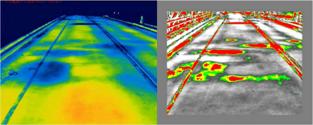
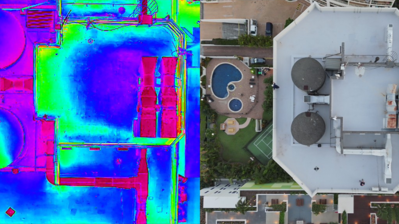
Thermal inspection services identify moisture intrusion, insulation failure, electrical anomalies and heat-related asset degradation not visible through standard visual inspection.
Using calibrated radiometric sensors, outputs include:
Georeferenced thermal anomaly reports
Temperature differential analysis
Integrated visual and infrared overlays
Documentation suitable for engineering review and insurance assessment
Thermal Inspection and Infrared Condition Assessment
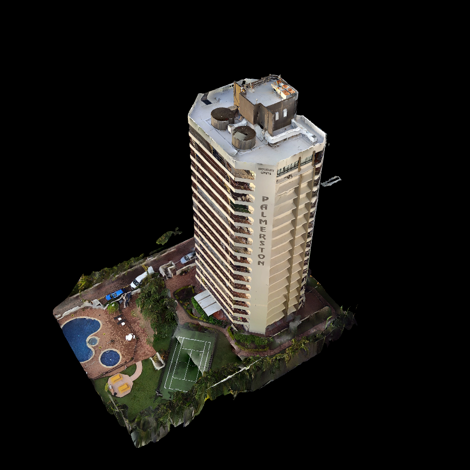
Digital Twin and 3D Asset Condition Modelling
Inspection data is transformed into spatially accurate digital twins that provide measurable, defensible representations of asset condition, before, during and after works. Digital twin modelling extends inspection outputs into measurable, time-comparable asset records.
Digital twin services support:
Defect mapping within 3D environments
Time-series comparison across inspection cycles
Integration into BIM and GIS asset systems
Lifecycle planning and capital prioritisation
Inspection Deliverables
Structured outputs designed for engineering review, asset management integration and governance assurance.
-
High-resolution visual and thermal imagery captured using standardised inspection protocols.
All imagery is geotagged, time-stamped and asset-referenced to enable repeat-cycle comparison and defensible record keeping.
-
Structured defect register including:
• Defect ID and spatial location reference
• Severity and priority classification
• Asset component tagging
• Linked supporting imagery and annotations
Formatted for engineering review and maintenance planning workflows.
-
Where applicable, calibrated radiometric thermal outputs including:
• Temperature differential analysis
• Anomaly mapping
• Visual and infrared overlay integration
• Engineering-ready interpretive summary
-
Spatially accurate 3D model or point cloud incorporating:
• Annotated defect mapping
• Measurement overlays
• Time-series comparison capability
• Export compatibility with BIM and GIS platforms
Provides measurable representation of asset condition at time of inspection.
-
Structured report including:
• Scope and methodology
• Access strategy
• Inspection limitations
• Summary of findings
• Risk observations
• Supporting photographic and spatial appendix
Designed to support governance, insurer review and third-party audit processes.
-
Inspection outputs delivered in structured formats compatible with:
• BIM environments
• GIS asset systems
• Enterprise asset management platforms
• Maintenance planning workflows
Data can be retained for repeat-cycle comparability and lifecycle planning.
Chain of Custody and Data Integrity
Metadata retention
Time-stamped capture logs
Flight and positioning records
Inspection protocol documentation
Data storage and retention alignment with client governance requirements
Key Benefits
Our inspection services are delivered through structured multi-sensor capture and inspection-grade processing, producing reliable, repeatable and decision-ready outputs.
-
Reduces reliance on scaffolding, rope access, shutdowns, and confined entry
Standardised capture workflows improve coverage and consistency
Georeferenced, time-stamped evidence supports audit, insurance, and compliance review
-
Inspection evidence is structured into clear findings that support prioritisation and planning.
Findings organised by asset/area, with geotagged references and annotated imagery
Condition observations summarised for rapid engineering review and decision-making
Outputs support maintenance planning, risk assessment, and targeted follow-up inspections
-
Evidence is captured and processed with traceability so stakeholders can review what was seen, where, and when.
Time-stamps, location references, and metadata preserved for each observation
Clear audit trail from raw evidence to annotated outputs and summaries
Suitable for governance reviews and third-party stakeholder engagement (e.g., insurers, regulators)
-
Standardised capture plans enable consistent re-inspection and objective comparison over time.
Repeatable viewpoints and capture routes create a baseline record for comparison
Time-series records support trending, defect progression analysis, and early intervention planning
Change-focused outputs highlight what has moved, degraded, or altered between inspections
-
Remote capture reduces downtime and enables inspection activity to run alongside live operations.
Minimises shutdown requirements, exclusion zones, and site access constraints
Faster mobilisation and data capture compared with traditional access methods
Enables targeted interventions by identifying issues early and focusing follow-up work
-
Outputs are delivered in practical formats that fit existing asset and engineering workflows.
Deliverables compatible with common GIS, BIM, and asset management workflows
Portable, reusable data packages that can be shared across teams and vendors
Supports integration into downstream engineering, maintenance, and reporting processes
Traceability: geotag, timestamps, metadata retention
Repeatability: standardised and geocaptured plans
Independence: evidence-led, no certification/remediation design
Stakeholder-ready: suitable for owners, engineers, insurers, and legal review
15–30 min • No obligation
Measureable Impact
Independent infrastructure case studies demonstrate:
Up to 60% cost reduction in high-access inspections
Up to 70% time savings
40% average savings in bridge programs
Reduced downtime in offshore wind and industrial environments
Safety and Exposure Reduction
Reduced high-risk access hours
Lower WHS exposure
Reduced downtime
Governance and Evidence Integrity
Traceable inspection records
Comparable time-series datasets
Improved capital planning confidence
Independent infrastructure case studies demonstrate measurable performance improvements when remote inspection technologies replace high-access methods.
Operational Efficiency
Up to 60% cost reduction observed in infrastructure case studies
Up to 70% time savings
Reduced shutdown duration
Scale Inspection Intelligence Across Your Asset Portfolio
This inspection intelligence methodology forms the operational foundation of our Annual Portfolio Inspection Program, enabling repeatable deployment, measurable condition tracking and portfolio-level risk visibility.