
Mining and Environmental Sustainability
DeepSkyIQ supports the mining sector with a wide range of drone and robotics capabilities.
Drone solutions help reduce downtime, lower labour costs, support preventative maintenance, improve lean management and strengthen sustainability outcomes across mining operations.
Our services cover high accuracy mapping, asset and infrastructure inspections, non destructive testing, pressure and soft wash cleaning, coating applications at height, water efficient cleaning, land and wildlife assessments, environmental monitoring, underground and high risk visual capture, LiDAR and thermal modelling, and high fidelity 3D digital twins with IoT enabled insights.
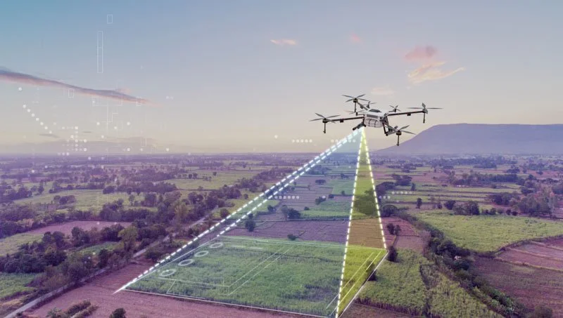
3D high-accuracy models, topographical maps, and near real-time visualisations, supporting planning, managing trailing dams, and understanding topographical changes.
Lorem Ipsum
Lorem Ipsum
Cleaning, Inspections and Coating Applications
Secure data links and encrypted communications ensure every feed is protected, indoors or outdoors.
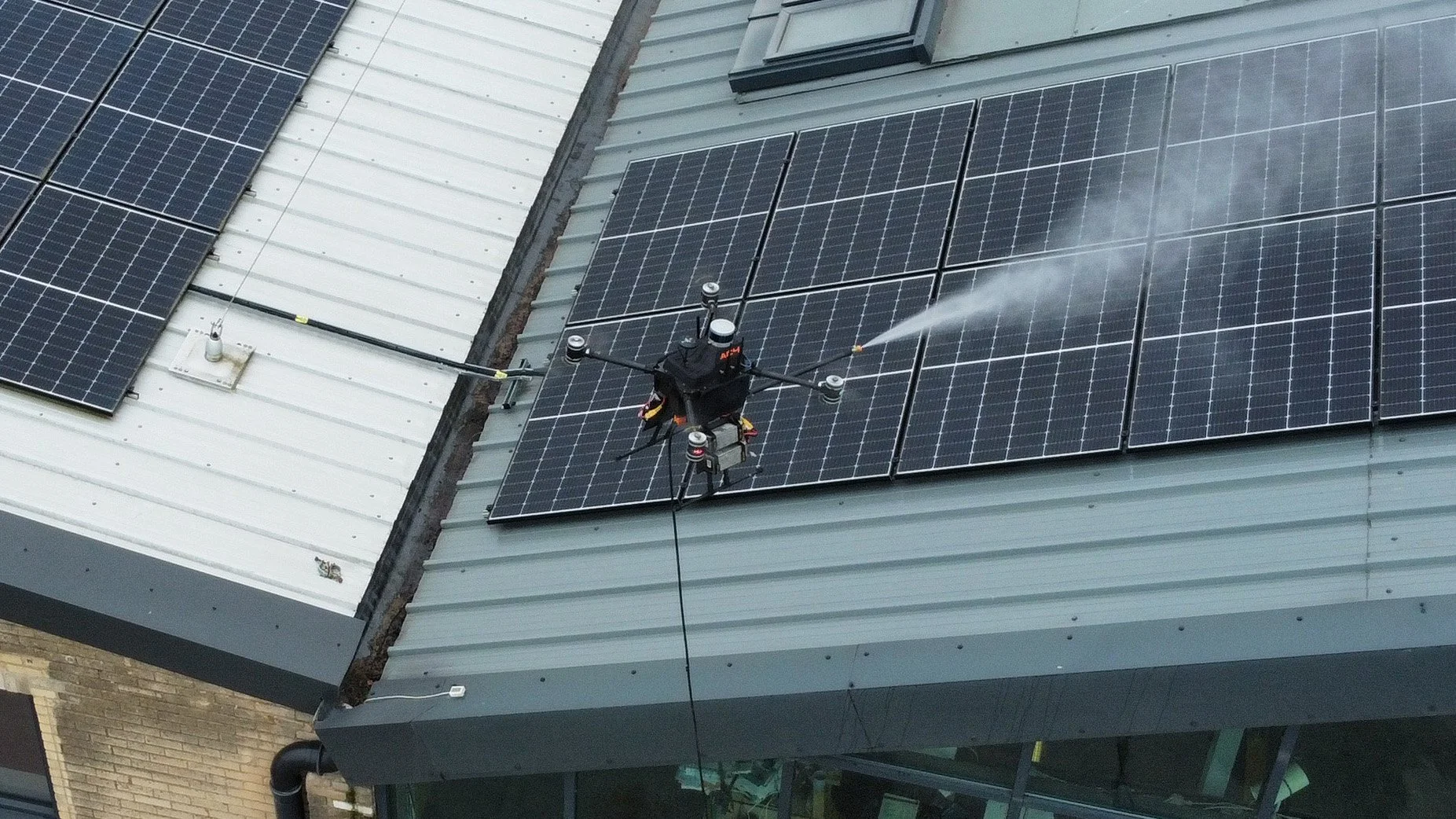
Our drone services provide mining-specific value for infrastructure and asset pressure and soft wash cleaning, comprehensive multimodal inspections, and the application of coatings to provide significant life cycle benefits while conserving vital resources. By extending asset lifecycles by up to 30% through precision cleaning and protective coatings, with our advanced AI-enabled inspections, we reduce maintenance costs by up to 40% and reduce unplanned asset downtime by 25%.
Additionally, our eco-friendly cleaning methods use up to 80% less water compared to traditional techniques, aligning with your sustainability goals and reducing environmental impact. These innovations ensure cost savings, resource efficiency, and operational excellence in your mining operations.

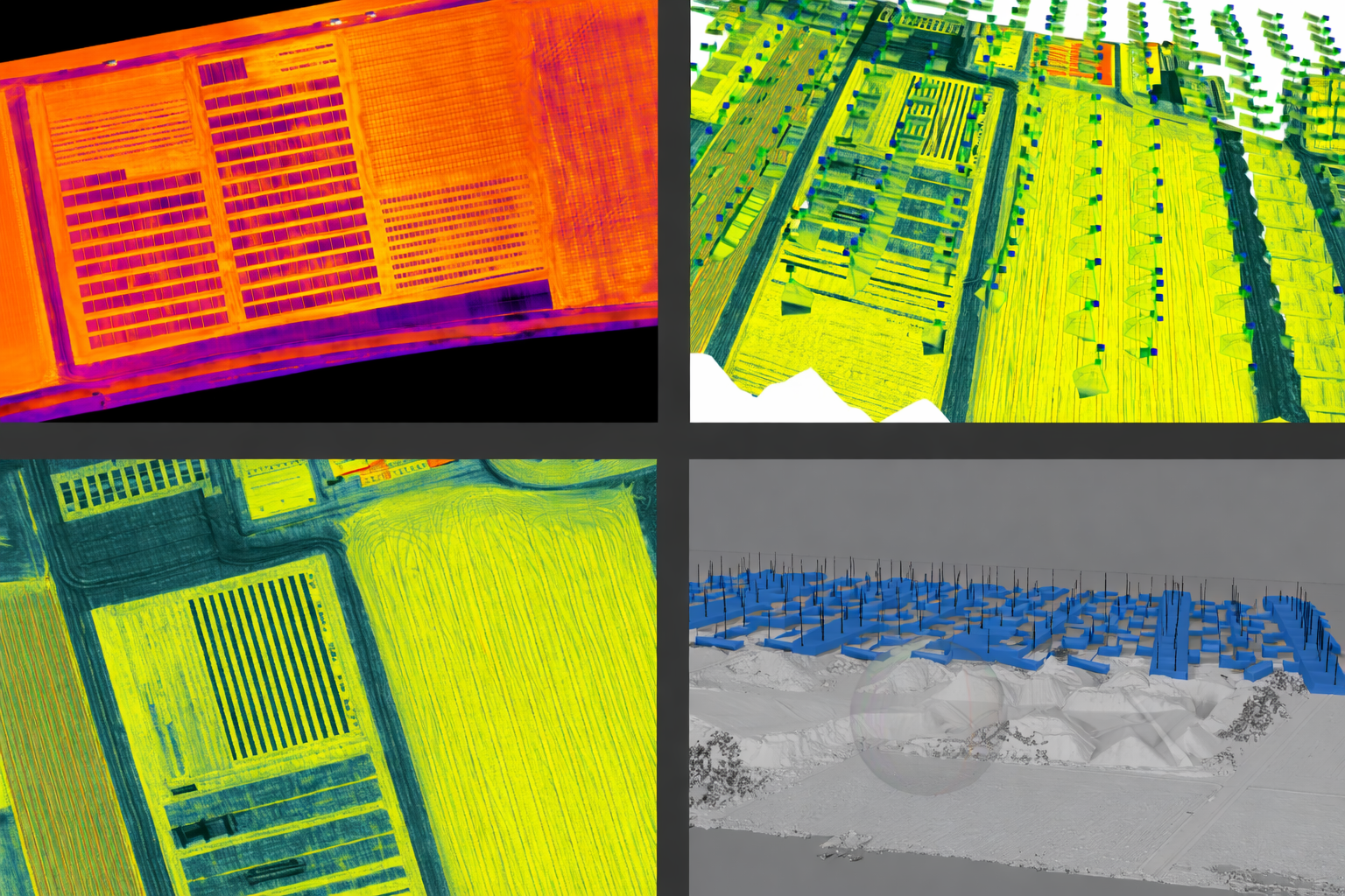
Digital Twin and 3D Mapping Solutions
High-resolution imaging and thermal overlays help teams assess scenes safely and allocate resources efficiently.
Our digital twin and 3D mapping services empower mining operations with accurate, real-time representations of mine sites and assets. By utilising high-resolution photogrammetry and LiDAR technology, we create precise digital replicas that optimise planning, monitoring, and asset management coupled with site logistics improvements with site-wide transparent and dynamic mapping.
These solutions reduce survey time by up to 50%, enhance safety by minimising on-site personnel requirements, and provide actionable insights for proactive maintenance and improve operational efficiency across your site.
Thermal Imaging and Inspection Services
Real-time intelligence helps teams cover more ground, respond faster and reduce risk.
DeepSkyIQ supports offshore and inshore operations with drones designed for long-range, all-weather performance.
Coast Guard and marine rescue
Search and rescue in dense forestry or rough terrain
BVLOS VTOL missions
Thermal, LiDAR and multispectral imaging for rapid location
Event Monitoring and Emergency Response
high fidelity 3D textured mesh models for investigations, insurance, legal processes and long-term resilience planning.
We create high fidelity 3D textured mesh models for:
Disaster planning and preparation
Post-incident reconstruction
Large area mapping
Crime scene and vehicle scene recreation
Aerial Surveillance and Security Solutions
transport mission-critical payloads, such as AEDs and trauma kits, in areas with limited access.
These systems are integrated with triple-zero workflows to provide real-time intelligence before first responders arrive on scene, improving safety and resource allocation decisions.
DeepSkyIQ supports the next generation of public safety tools:
Drones as First Responders (DFR)
24/7 autonomous drone-in-a-box systems
Vehicle-mounted drone systems
Remote operations capability
Proactive Maintenance with IoT Integration
drone-based communications relays to keep teams connected during outages or in remote areas.
With 720-degree obstacle sensing, GPS-denied operation capability and full data encryption, our systems operate safely in complex indoor and outdoor environments while ensuring information security at every stage
Frequently Asked Questions
-
Inspections, digital twins, cleaning, predictive maintenance and compliance for turbines, solar, substations and power infrastructure.
-
LiDAR mapping, stockpile analysis, emergency response, asset inspections, water efficient cleaning and environmental monitoring.
-
Progress tracking, 4D and 5D digital twins, QA validation, volumetrics and site safety intelligence.
-
Event monitoring, first response, autonomous surveillance and real time data for risk and safety teams.
-
Bridge inspections, road and tunnel mapping, rail assessments and multi sensor condition analysis.
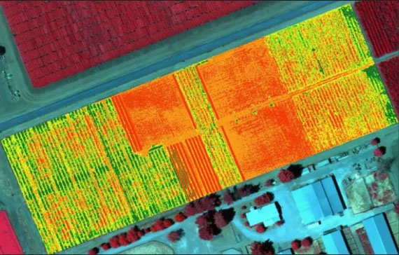
Environmental and Sustainability Monitoring
Drone solutions for environmental monitoring provide critical data for managing and reducing the environmental impact of mining activities.
From air quality assessments to vegetation health analysis, our drones help operators comply with regulations and implement sustainability initiatives.
These services reduce environmental assessment time by up to 50% and support eco-friendly practices, aligning with corporate social responsibility goals.