
Underwater & Submerged Asset Intelligence
Engineering-grade data for your most critical underwater assets & infrastructure.
ISO 9001 |
ISO 45001 |
ISO 14001 |
CASA ReOC |
$20M Insured |
Bridge Inspection L1 |
ISO 9001 | ISO 45001 | ISO 14001 | CASA ReOC | $20M Insured | Bridge Inspection L1 |
The High Cost of Uncertainty
Diver-led inspections can cost up to 5 times more than ROV-based programs due to support vessels and personnel requirements.5x higher costs
Traditional methods put human divers in hazardous underwater environments, creating unnecessary liability.100% risk exposure
Subjective, inconsistent diver reports make it impossible to track asset degradation over time.Zero baseline data
100% human risk reduction
Up to 68% lower costs of inspection
40-60% improvement in defect detection
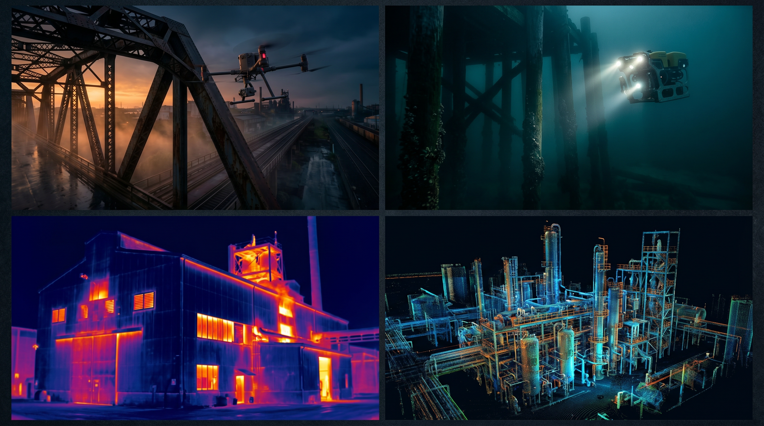
One Partner. Four Environments. Total Asset Intelligence.
One procurement, four environments
Stop managing separate contractors. We cover air, ground, confined space, and underwater assets in a single, integrated program.
Digital twins accurate to 2cm
Measure, plan, and simulate remotely with centimetre-accurate 3D models. No need for costly return site visits.
Find every defect.
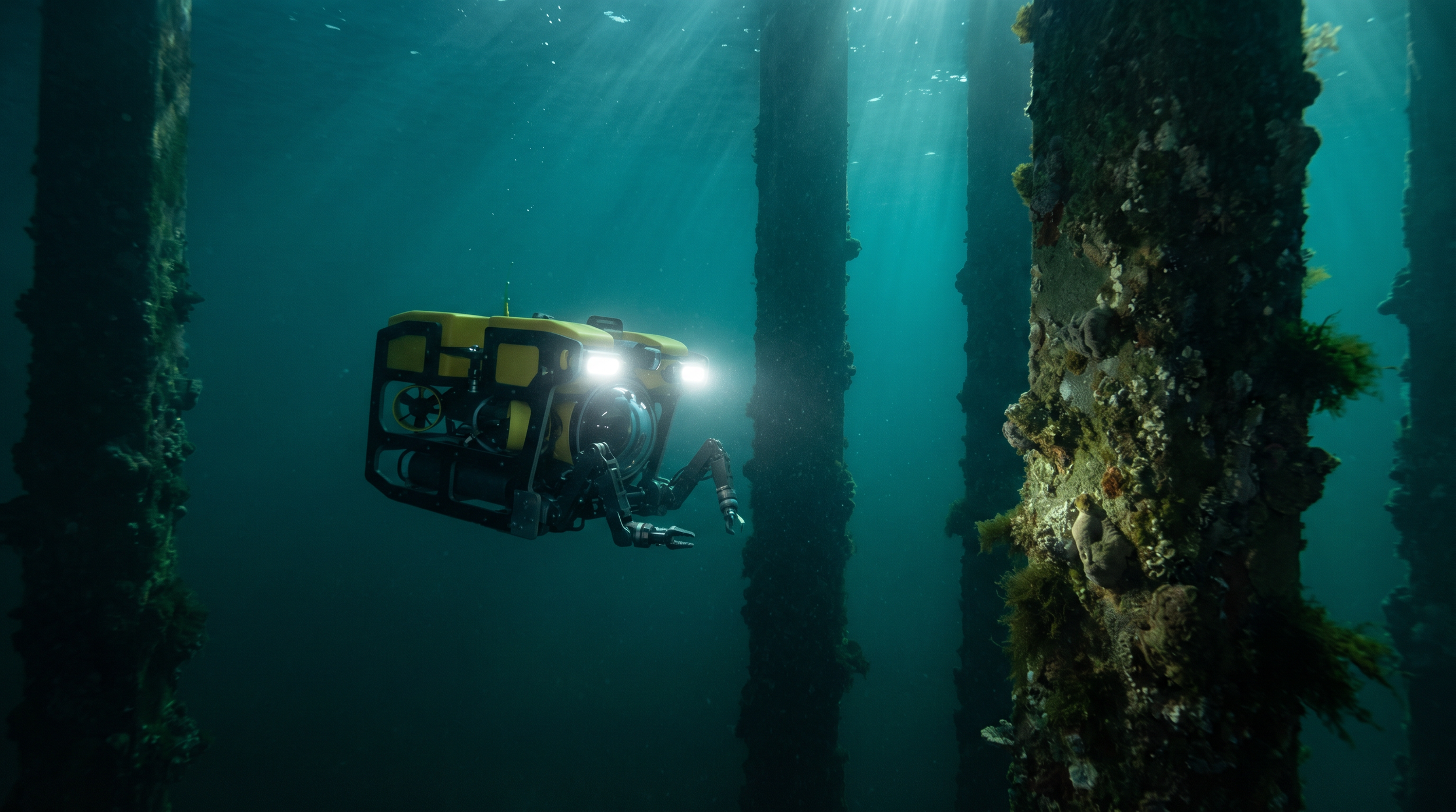
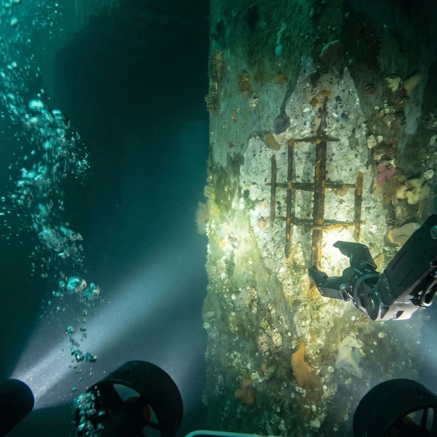
We combine 4K UHD visuals, 10,000 Luman lighting, AI dehazing algorithms to filter suspended particles, sonar, dual Q-DVL for holding position up to 3 knots, AI smart measurement, macro focus, and LiDAR data to identify and measure corrosion, cracking, and structural anomalies that divers miss. Capture fine detail on weld seams, bolt connections, and micro-cracking at extreme close range. Platform options are available for depths of 200m to 500m.
AI-powered measurement to 99.7% accuracy.
Our platforms use dual-laser and AI algorithms to measure fractures, damage, and deformation in real time, giving your engineers precise, non-destructive data without a diver in the water.2D and 3D seafloor mapping in a single pass
Integrated bathymetric tools generate topographic maps, depth contours, and reservoir capacity estimates with one-click reporting.Data you can trend
Autonomous navigation with inertial positioning (U-INS) ensures repeatable flight paths, so every survey captures comparable data for accurate degradation tracking over time.Rapid response for critical assets & search and rescue
At less than 7kg with hot-swappable batteries, our ROV systems deploy anywhere in Australia within hours for emergency inspections, critical response needs whilst minimising downtime.See how our integrated approach can reduce your inspection costs and eliminate safety risks.
Applicable Industries
Explore a curated collection of our past work, where imagination meets strategy. Each project reflects our drive to deliver thoughtful, effective solutions.


Frequently Asked Questions
What assets can you inspect?
1
We inspect a wide range of submerged assets, including wharf piles, jetties, ship hulls, sea walls, bridge foundations, dam walls, reservoirs, pipelines, and other critical infrastructure.How deep can your ROVs operate?
2
Our primary platform is rated to 200 metres with a 200m tether, covering the vast majority of coastal, port, dam, and inland waterway infrastructure. It operates in currents up to 3 knots and temperatures from -10C to 60C. However, upon request, we can also access a platform suitable for depths of 500m.We deliver data in industry-standard formats compatible with all leading asset management, GIS, and digital engineering platforms for seamless integration.What data do we receive?
3
Standard deliverables include 4K UHD video, 12MP RAW photography, measurement data, and a structured condition report. We also deliver 3D models, point clouds, and bathymetric maps for integration into your digital twin or GIS platforms, compatible with all standard asset management and digital engineering platforms for seamless integration.Is this service more expensive than using divers?
4
See How We Can Cut Your Inspection Costs?
Partner with DeepSky IQ to unlock a safer, smarter, and more cost-effective approach to managing your submerged infrastructure.No, our service is significantly more cost-effective, with studies showing cost reductions of up to 68% compared to traditional diver-based methods. We deliver data in industry-standard formats compatible with all leading asset management, GIS, and digital engineering platforms for seamless integration.