
Assets & Infrastructure Precision Inspection & Condition Intelligence
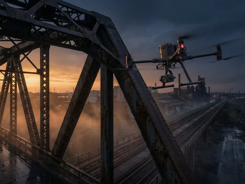
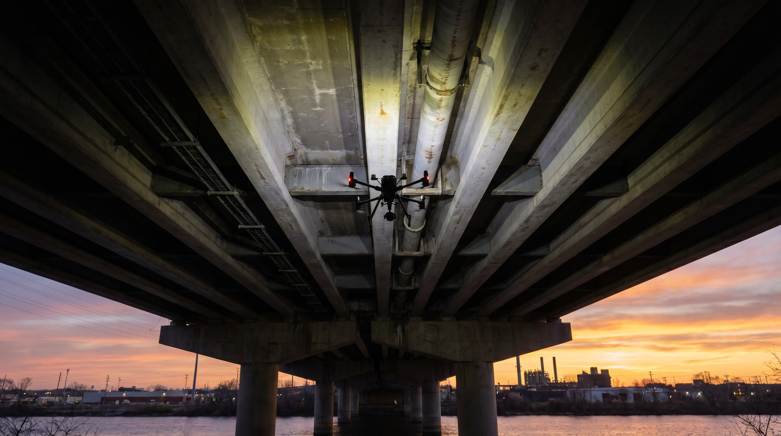
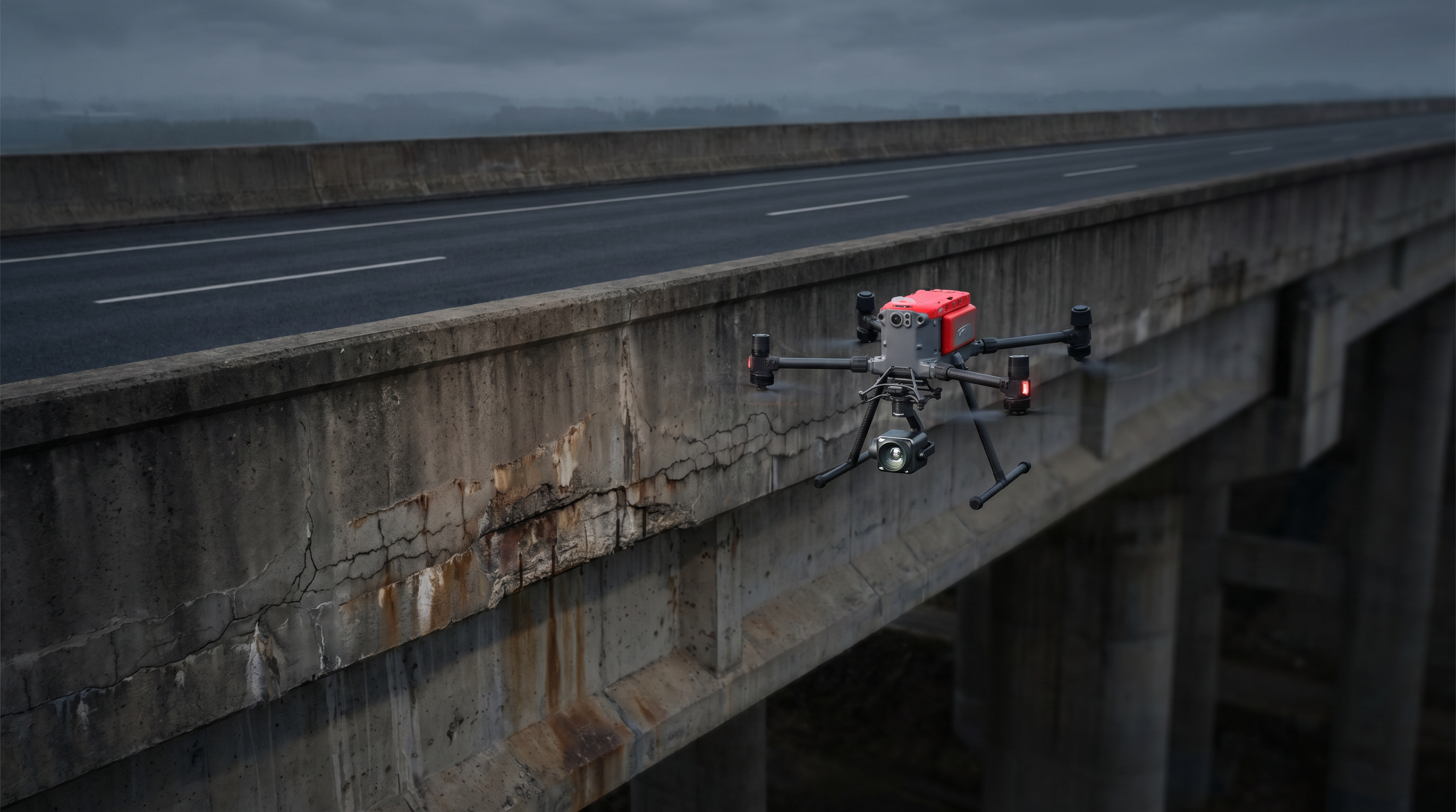
High-fidelity Data Capture: Drones, Robotics, ROV, 360-degree data acquisition: For asset inspection, condition monitoring, engineering-grade datasets, rapid analysis and digital twins decision support.
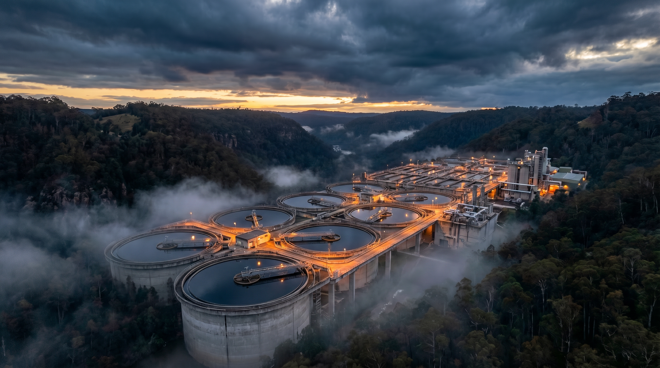
All Assets. All Environments. One Complete Data Set.
All Assets. All Environments: Aerial, Ground, Interior, Submerged, and Confined Spaces.
ISO 9001 |
ISO 14001 |
ISO 45001 |
CASA ReOC |
$20M Insured |
Bridge Inspection L1 |
ChemCERT |
OONP |
EVLOS 1 & 2
Night Operations |
EBVLOS |
Sheltered Operations |
Qld Environment, Tourism & Innovation: Registered Suitable Operator |
ISO 9001 | ISO 14001 | ISO 45001 | CASA ReOC | $20M Insured | Bridge Inspection L1 | ChemCERT | OONP | EVLOS 1 & 2 Night Operations | EBVLOS | Sheltered Operations | Qld Environment, Tourism & Innovation: Registered Suitable Operator |

Making Critical Decisions with Incomplete Data
You're also having to manage risk mitigations for high-risk working at height, confined spaces or underwater, creating OHS exposure.Incomplete, non-current and inconsistent reportingNo structured year-on-year comparabilityShutdown dependency, cost and disruptionInflated access costs and lost productivityDelayed defect detection is driving reactive maintenance cycles, increasing cost by up to 40%High insurance premiums & replacement costsManual inspections cost 3-5x more than digital twin data-driven maintenance programs.
Up to 85% of critical sub-surface defects are missed by visual-only inspections.
Fragmented data from multiple sources prevent effective lifecycle analysis, shorten the asset lifecycle by 30%, and cost you 40% more to maintain.
“20-60% lower inspection costs”
“90% less risk”
“ 50% faster”
Actionable Intelligence from a New Perspective
One partner. Four environments.
Engineering-grade data your team can act on today.
One procurement, four environments.
Stop managing multiple contractors. We cover air, ground, confined space, and underwater assets in a single, unified intelligence program. Captured by aerial drones, 360 Cameras & ground robotics, confined space specialised drones and submerged ROVs, using thermal, high resolution visual, photogrammetry, lidar and multispectral sensors.Digital twins accurate to +/- 2cm.
Measure, plan, track, categorise, prioritise, allocate, and monitor remotely using survey-grade 3D to 8D interactive models. Eliminate costly and unnecessary return site visits and unplanned CapEx.Find what the eye can't see.
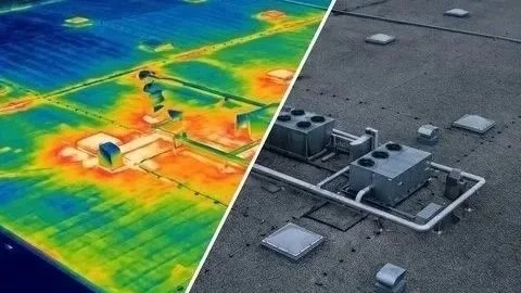
Our fused sensor data (visual + thermal) reveals subsurface defects, increasing detection by up to 60% and allowing you to act before minor issues become major failures.Zero or Minimum Operational Disruption.
We hold advanced CASA approvals (EVLOS, EBVLOS, OONP, sheltered & night operations) to conduct detailed inspections without requiring shutdowns, traffic control, scaffolding, ropes, high-risk entries or production downtime where possible.The Value
20-60%
Reduction in Inspection Costs
Cut inspection costs by eliminating the need for scaffolding, rope access, and lifts, and reduce reactive maintenance expenses by as much as 60% by deploying remote, automated inspection systems.159.7%
Improved Defect Detection
Reveal concealed subsurface defects and subtle thermal anomalies that are invisible to the naked eye by leveraging our advanced, multi-sensor inspection approach, combining high-resolution imaging, thermal analysis, and precision sensing for comprehensive, engineering-grade diagnostics.40%
Reduction in Reactive Maintenance Costs
Predictive maintenance can cut costs up to 40% vs. reactive fixes by spotting wear early, cutting downtime, extending asset life, and right-sizing spare parts.

Continuous monitoring and data-based diagnostics mean parts are serviced only when needed, reducing labour, insurance premiums, lost production, and secondary damage, resulting in savings and higher reliability.
90%
Risk Mitigation
Remove personnel from hazardous environments such as working at heights, operating in confined spaces, or working near live infrastructure, to reduce or remove risks and improve safety outcomes.We replace scaffolding and guesswork with RTK-enabled precision and multi-sensor capture. Our enterprise drone fleet delivers objective, repeatable data that integrates directly into your existing asset management workflows.Millimetre-Level Accuracy:
We utilise Emlid RS3 receivers, checkpoints and ground control points to achieve +/-2cm positional accuracy, ensuring your digital twins and inspection models are spatially defensibleMulti-Sensor Intelligence:
We capture high-resolution RGB, radiometric thermal (FLIR), and 360-degree data simultaneously, providing a comprehensive view of asset health.Enterprise Processing:
Data is processed through enterprise software, transforming raw imagery into actionable, measurable 3D models and orthomosaic.Minimum Operational Disruption:
Our CASA-certified pilots operate safely alongside your active site, eliminating or minimising the need for costly shutdowns, operational disruptions or exclusion zones.Precision Data Capture at Scale
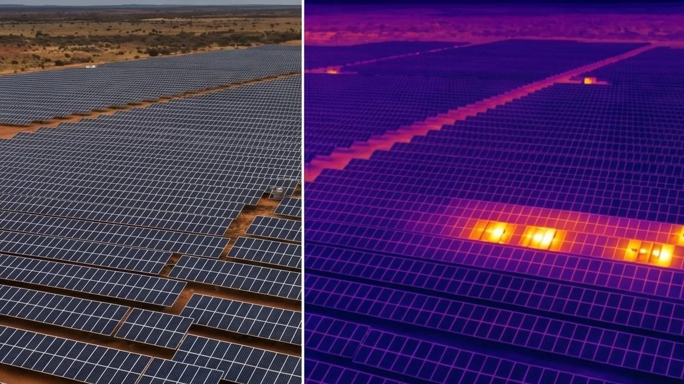
Thermal Inspection and Infrared Condition Assessment
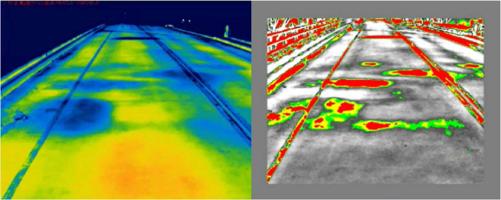
Thermal inspection services identify temperature differentials indicating moisture intrusion, insulation failure, electrical anomalies, and heat-related asset degradation not visible through standard visual inspection alone.Using calibrated radiometric sensors, outputs include:Georeferenced thermal anomaly reportsTemperature differential analysisIntegrated visual and infrared overlaysDocumentation suitable for engineering review and insurance assessment
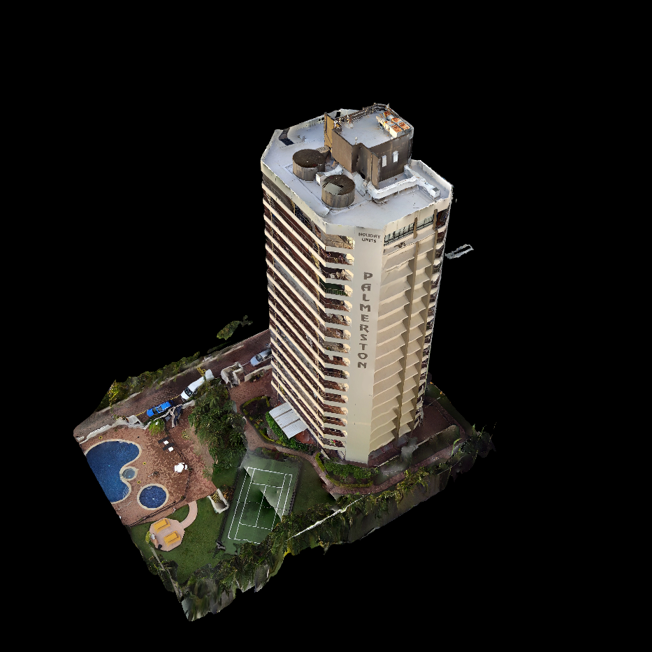
Digital Twin and 3D Asset Condition Modelling
Inspection data is transformed into spatially accurate digital twins that provide measurable, defensible representations of asset condition, before, during and after works. Digital twin modelling extends inspection outputs into measurable, time-comparable asset records.Digital twin services support:Defect detection, mapping and trackingTime-series comparison across inspection cyclesIntegration into BIM and GIS asset systemsLifecycle planning and capital prioritisationRTK/PPK with Ground Control Points for faster defect rectificationsStakeholder communicationProject scheduling, quality, and budget controls
Applicable Industries
Bridges, rail corridors, roads, pavements, culverts and tunnels.Power lines, substations, solar farms, dams, wires, pipelines, tanks, and mining assets.
Policy assessment, pre & post claims, forensic data capture & 3D digital twins for claims assessment and dispute resolution.Infrastructure management, emergency planning, response and recovery, and environmental monitoring.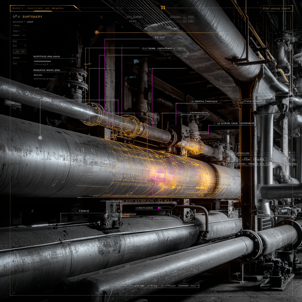
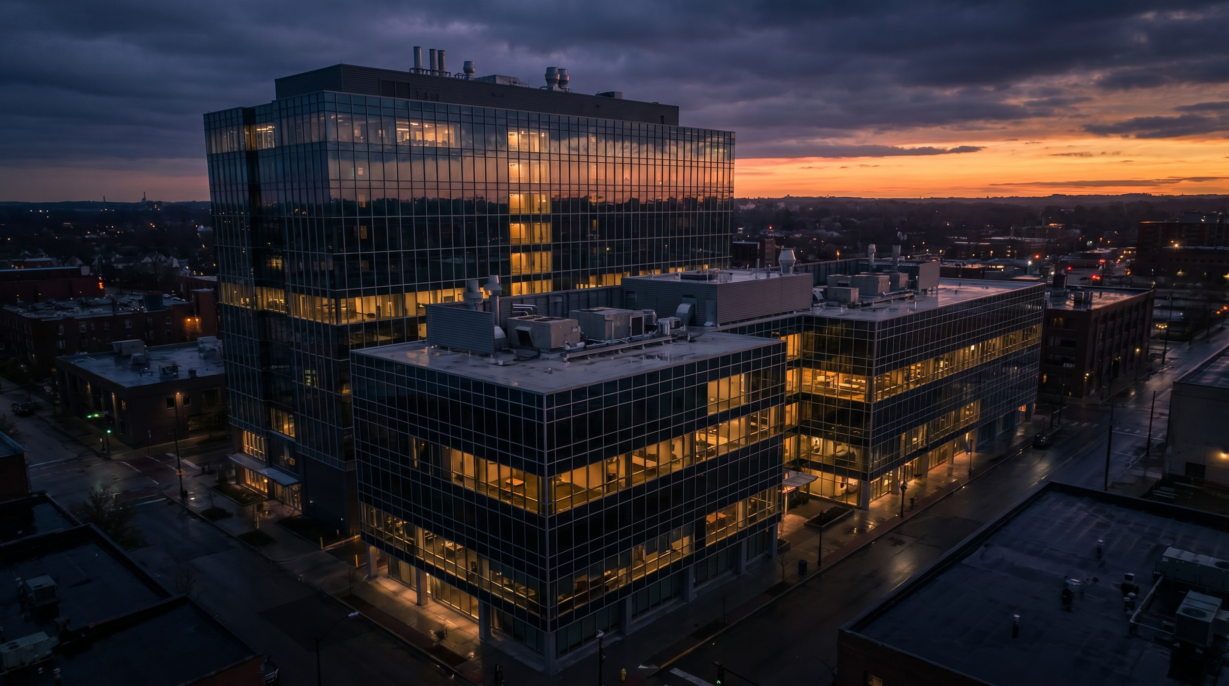
Facade inspections, roof assessments, and portfolio-wide condition monitoring.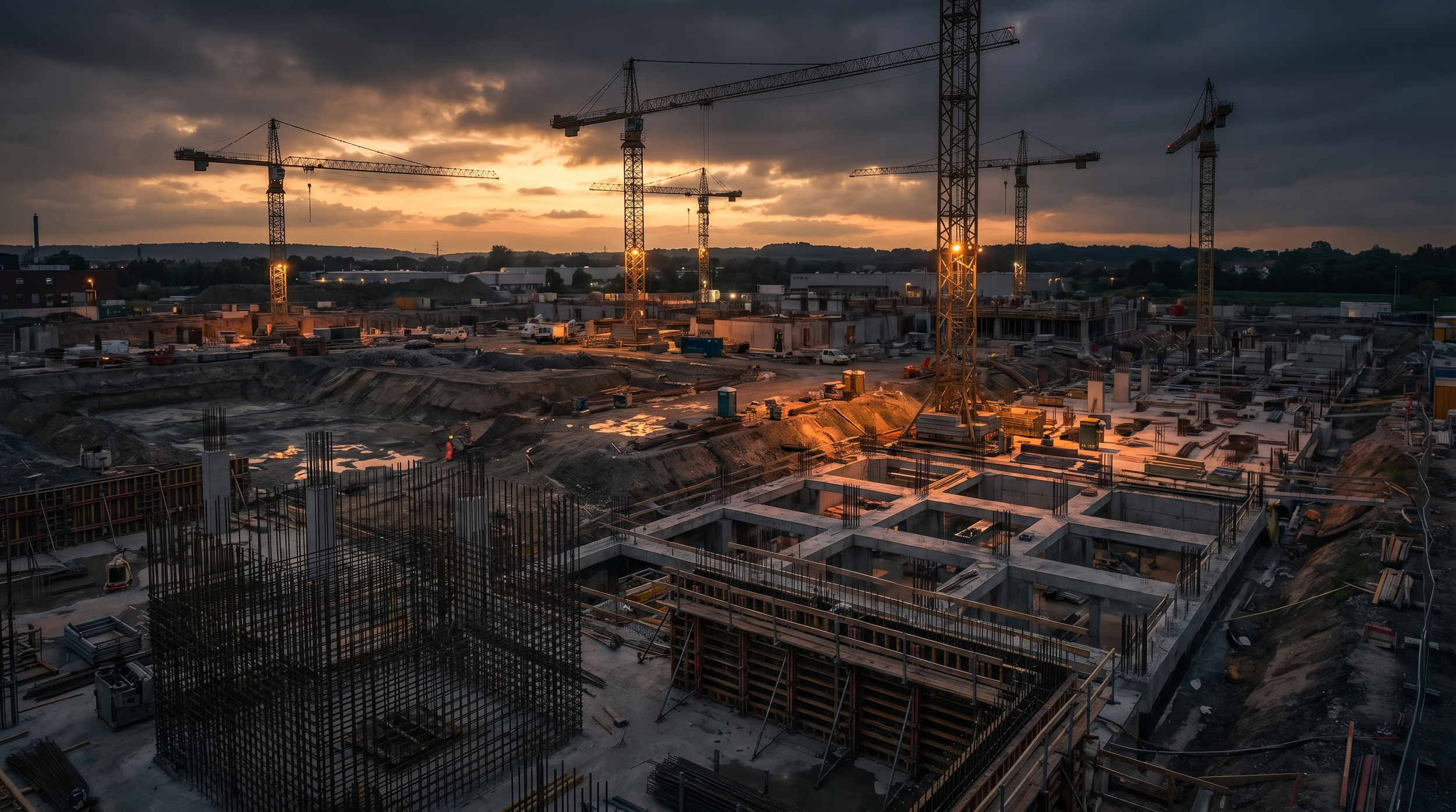
Pre-tender animation overlays, Site earthworks & AR capture, project progress monitoring, volumetrics, quality assurance, safety AI compliance, time series and as-built verification.
Frequently Asked Questions
-
Most standard asset inspections are completed within a single day on-site, compared to the days or weeks required for scaffolding setup and manual inspection. Complex or sprawling sites may take longer, but we will be able to define the exact timeline during our initial scoping phase.
-
DeepSky IQ operates under a fully certified commercial operators CASA licence. In addition to our ReOC, our pilots hold advanced approvals including EVLOS I & II, Enclosed BVLOS, Sheltered operations for indoor work in GPS denied environments, lifts shafts, pipeline inspections, tunnels or indoor roof spaces. Over Or Near People with mitigations in place and Night Operations supported by thermal, IR and Spotlight mounted systems, allowing us to operate in complex industrial environments where standard drone operators cannot.
-
This depends on what your use case is. We are able to provide simple to complex outputs from simple interactive 3D models of a building, to geo-referenced relative or absolute accuracy inspections and dilapidation reports, with engineering-grade outputs which are all tailored to your requirements agreed during scoping.
They can typically include high-resolution orthomosaics, measurable 3D point clouds, thermal analysis reports, and raw multi-sensor imagery, all accessible via enterprise platforms or integrated into most BIM/CAD/Procure systems and more.
-
We eliminate the primary sources of risk by removing the need for personnel to work at heights, enter hazardous environments, or work near live infrastructure. This significantly improves safety outcomes and reduces liability.
-
No. Our advanced CASA endorsements allow us to conduct inspections with zero operational disruption unless safety issues are identified, then we will work through the best time to capture the data with you. We can usually capture data on live assets without requiring shutdowns, traffic diversions, or you incurring operational downtime by gaining consent to fly.
-
We are an asset intelligence company, that uses drones and robotics to gather the data not just a drone operator. We provide an end-to-end solution that includes mission planning, risk assessments & mitigations, advanced data capture that is engineering grade and the analysis, delivering actionable insights that integrate with your existing platforms. We provide answers, process into digital twins and provide comprehensive insights, not just photos.
-
We provide engineering-grade data with accuracy down to +/- 2cm using advanced RTK/PPK GPS technology. This ensures the data is reliable enough for precise measurements and survey-grade digital twins.