

Engineering-Grade Mapping, Measurements & RTK Spatial Data
Survey-grade drone maps, RTK-validated spatial data, and volumetric stockpile measurements that form digital twins, reducing rework, confirming costs, preventing disputes, and limiting commercial risk with defensible spatial validation.
The Challenge: Inaccurate or Inconsistent Data
Inaccurate or inconsistent spatial data introduces measurable commercial risk across contracts, certification and lifecycle governance.Common consequences include:• Quantity and volumetric ambiguity• Delayed approvals and certification cycles• Contract disputes and variation claims• Rework due to inconsistent baselines• Fragmented asset records• Limited lifecycle comparabilityThe Cost of Fragmented Spatial Data
Industry studies show:• 14% of global construction rework is linked to poor data management
• 80% of large projects exceed budget
• Data silos drive avoidable delay, duplication and claims exposure
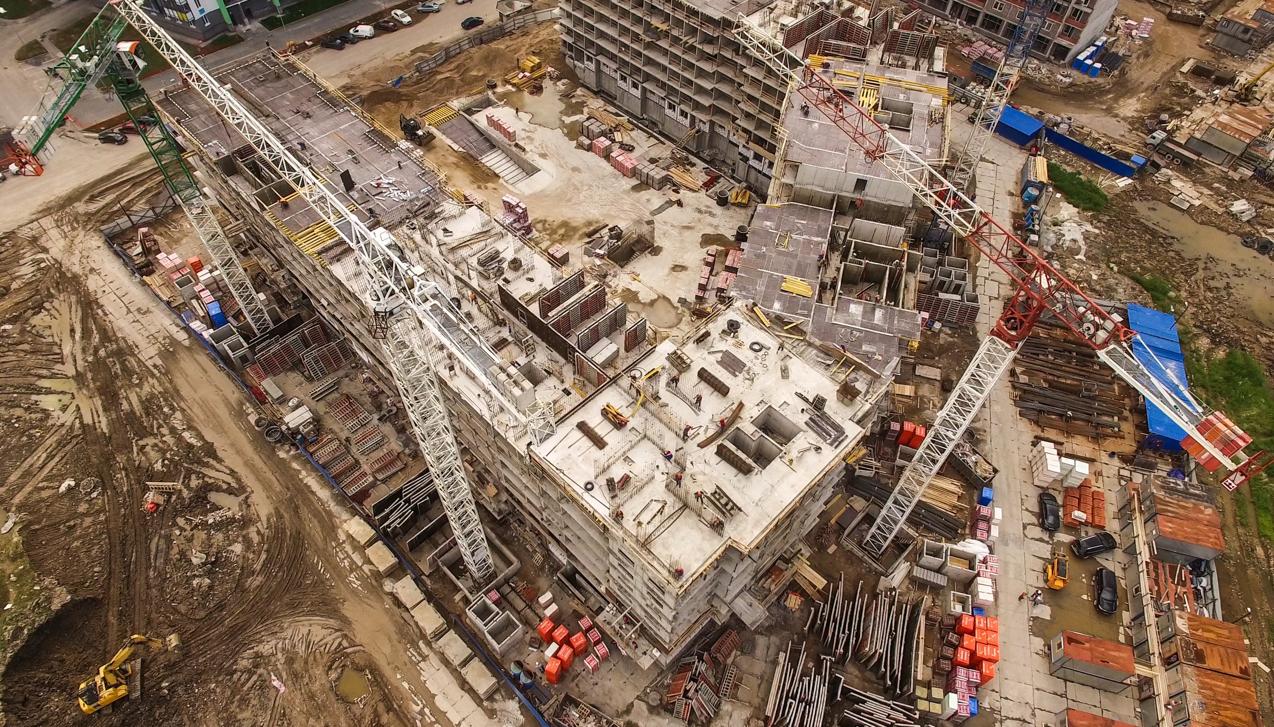
Our Solutions: Survey-Grade Deliverables
Structured, georeferenced datasets for engineering sign-off, commercial validation, and long-term asset management across environments.Deliverables:
RTK-enabled orthomosaics
High-accuracy terrain models (DSM/DTM)
Volumetric and stockpile reports
Cut-and-fill analysis
As-built and progress verification
Change detection and deformation monitoring
Corridor and linear-asset mapping
3D digital twins for remote validation, time-series comparison, and lifecycle condition tracking
BIM, CAD, and GIS-ready exports
Quantity disputes cost projects 5-15% of contract value. Eliminate ambiguity.
Operational and Commercial Impact
“14% of global construction rework is linked to poor data management”
Volumetric Stockpile Data, Cut and Fill metrics with visualisation, slope assessment within a holistic measured Digital Terrain Model and cost impacts by DeepSky IQ
-
Controlled and repeatable georeferencing via RTK capture workflows ensures spatial consistency and measurement integrity across projects.
-
Georeferenced, timestamped datasets provide a single source of truth for all parties. When quantities are disputed, our volumetric data is defensible to survey-grade accuracy.
This approach can result in upto a 70% reduction in variation claims when RTK-validated spatial data replaces manual measurement methods.
Every dataset is repeatable and comparable over time, eliminating "he said, she said" disputes.
-
Same-day preliminary data for urgent decisions. Full processed deliverables within 5-7 business days.
Our rapid capture-to-insight pipeline means project managers, engineers, and commercial teams get the spatial intelligence they need in days, not weeks. Faster data means faster approvals, faster claims processing, and fewer delays waiting for survey teams to schedule and mobilise.
-
RTK/PPK workflows with GCP validation deliver datasets that meet engineering sign-off requirements. Every deliverable includes accuracy reports, coordinate system documentation, and quality assurance metadata. Your engineers can certify quantities, validate progress, and approve payments with confidence that the underlying spatial data meets Australian survey standards (GDA2020/MGA2020).
-
One methodology, consistent accuracy, any site.
Whether you're managing a single earthworks project or a portfolio of 50+ sites across multiple states, our capture workflows deliver comparable, standardised datasets.
Programmatic pricing for multi-site engagements reduces per-site costs as you scale, and our national deployment capability means consistent data quality regardless of location.
-
Progress claims backed by spatial evidence to process faster.
Our timestamped orthomosaics and volumetric reports provide the objective verification that contract administrators need to approve payments without site visit delays.
Reduce claim turnaround from weeks to days, improve cash flow for contractors, and give principals confidence that claimed quantities match actual progress.
-
Track actual vs planned quantities in near real-time. Our cut-and-fill analysis, stockpile measurements, and progress monitoring vs build tracking give commercial teams early warning of budget variances before they compound. Identify over-excavation, material wastage, or scope creep within days of occurrence, not at end of the month reconciliation when it's too late to course correct.
-
Historical spatial data combined with current progress creates a powerful forecasting tool.
Track production rates, predict completion dates, and model scenarios based on actual site performance rather than assumptions.
Our time-series datasets enable trend analysis that improves the accuracy of programme forecasts and helps project directors make informed decisions about resource allocation and milestone commitments with increased confidence.
FAQ's
How accurate is your spatial data?
We deliver survey-grade accuracy using RTK/PPK GNSS workflows validated with ground control points. Typical absolute accuracy is 2-3cm horizontal and 3-5cm vertical, meeting Australian survey standards for engineering and commercial applications.
What coordinate systems do you deliver in?
All data is delivered in GDA2020/MGA2020 as standard. We can also deliver in project-specific coordinate systems, local grids, or legacy datums (GDA94) on request. Coordinate system documentation is included with every deliverable.
How often should we capture spatial data?
This depends on your project dynamics. Active earthworks sites typically benefit from weekly or fortnightly captures. Construction flythrough weekly for project progress and variation reporting. Stockpile audits may be monthly or quarterly. We structure programs around your reporting cycles and commercial milestones.
How does this compare to traditional ground survey?
Our methods capture 10-50x more data points per site visit with comparable or better accuracy for surface measurements and provide accurate DSMs and DTMs. Traditional survey remains superior for sub-centimetre point accuracy on specific features such as boundaries, but for area-based measurements (volumes, surfaces, progress), drone-based spatial capture is faster, more comprehensive, and more cost-effective. We recommend using licenced surveyors when cadastral data is required, as it must be certified specifically by a surveyor.
How much does a survey-grade drone survey cost in Australia?
Survey-grade drone surveys in Australia typically represent a 40-60% cost reduction compared to traditional ground survey methods for equivalent accuracy. Our RTK-enabled capture with Emlid RS3 ground control achieves plus or minus 2cm positional accuracy, which satisfies engineering design and as-built verification requirements. For ongoing programs with multiple sites, we offer structured pricing that reduces per-site costs further. Every engagement begins with a free scoping call to define your accuracy requirements and deliverables before quoting.